Satellite Classification of Productive Land - AI Analysis
Multi-year satellite imagery analysis to track land productivity changes and identify areas requiring mine action intervention.
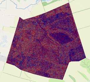
Land Classification Over Time (2020-2023)
2020
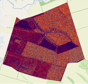
Baseline assessment
2021
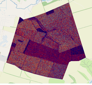
Impact assessment
2022
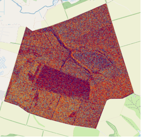
Progress tracking
2023
Latest analysis
Aerial View Analysis
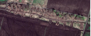
High-resolution aerial imagery reveals defensive positions, trenches, and earthworks that require specialized clearance techniques. Our AI algorithms identify patterns of disturbance and prioritize areas for detailed assessment.
Impact Crater Detection
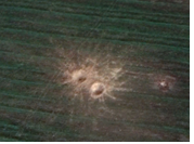
Advanced image processing techniques detect impact craters and explosive remnants through multi-spectral analysis, enabling precise targeting of clearance operations.
Ukraine Crop Classification Map
Regional Crop Classification
Interactive map showing agricultural land use patterns
Cereal
Sunflower
Maize
Soybeans
Rapeseed
Sugar Beet